Our archive and search room is now open on Tuesdays and Thursdays from 10am to 4pm. Keep up to date via our Facebook page and Twitter.
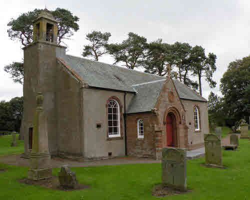
Skirling
Skirling is a small parish on the western edge of the County of Peebles and it is now one of the linked Parishes of Upper Tweeddale. Kirkurd Parish is to the north east and the combined parish of Broughton, Glenholm & Kilbucho is to the east & south. Lanarkshire lies to the west of Skirling.
Old Parish Records cover the periods:
Births: 1683-1854 (Mothers' names are not recorded until 1729)
See our sales list for full details and cost of postage.
Volumes available for consultation within our Archive
Pre 1855 Monumental Inscriptions of Peeblesshire by S.A. Scott published by Scottish Genealogical Society 1971.
Rutherford's Southern Counties Register and Directory 1867.
County Directory of Scotland 1912 - Borders Towns and Villages.
Magazine Articles
Please note that the heading Author includes persons who have compiled or transcribed records; and that the topics indexed, and the synopses are subjective opinions. See the Sales List to buy copies of the magazines containing articles in which you're interested.
Title
Synopsis
Size Description
Issue No
Author
The Tweedsmuir Sacrifice
An account of the sacrifices and losses of the Parishioners of Tweedsmuir during W.W.1. and of one family in particular.
2 pages or more
96
Ian Renwick
Map of Skirling from UK Great Britain, Ordnance Survey one-inch to the mile (1:63,360), 'Hills' edition, 1885-1903 by kind permission of the National Library of Scotland. Use the control at the top left of the map to zoom in or out and drag the map left, right, up, or down as you wish.
Map of Skirling from UK Ordnance Survey Historical Maps from 1919-1947 by kind permission of the National Library of Scotland. Use the control at the top left of the map to zoom in or out and drag the map left, right, up, or down as you wish.
Other Sources
The Buildings of Scotland - Borders, Cruft, Dunbar & Fawcett, Yale University Press, London 2006
The Statistical Accounts of Scotland compiled initially between 1791 and 1799, with a subsequent edition between 1834 and 1845 are a valuable record of the geography, history, economy, people and customs recorded by local ministers. You'll need to search for the parish name.
Skirling Parish General Register of Poor 1858-1928 - ref: SBA/360/64
Skirling Parish Record of Applications for Poor Relief 1855-1923 - ref: SBA/360/65
Skirling Parish Register of Poor Persons on the roll of the Parish 1845-1902 - ref: SBA/360/66
Skirling Parish Pay Roll Registered Poor 1855-1908 - ref: SBA/360/67
Skirling Parish Visiting Book Registered Poor 1855-1909 - ref: SBA/360/68
Skirling Parochial Board Pay Roll of Registered Poor and other Parishes 1992-1925 - ref: SBA/360/92
The National Archives of Scotland
Skirling kirk session records (Ref - CH2/329)
Minutes 1654-1659, 1701-1713, 1718-1720, 1765-1853 - with gaps
Accounts 1658-1675, 1690-1697, 1701-1714
Skirling Free Church Records (Ref - CH3/900)
History - The minister of the parish and most of his congregation left the Established Church at the Disruption. The congregation was well managed and built a church in 1843.