Our archive and search room is now open on Tuesdays and Thursdays from 10am to 4pm. Keep up to date via our Facebook page and Twitter.
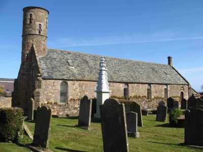
Cockburnspath
Cockburnspath is a coastal Parish in north east of Berwickshire with the County of Midlothian to the north-west, the North Sea to the north-east, the Parish of Coldingham to the south and the Parish of Abbey St. Bathans on the south-west.
We are currently working on recording the gravestone inscriptions.
See our sales list for full details and cost of postage.
Volumes available for consultation within our Archive
Brothers in Arms - Cockburnspath WW1
Cockburnspath - a history of its people and a place
Cockburnspath Historical Hamlet - Cockburnspath Community Council
County Directory of Scotland 1912 - Borders Towns and Villages
Index to Particular Register of Sasines for Berwickshire
Land Ownership Commission Report 1872 -1873 (CD)
Pigot's 1837 Directory of Berwickshire and Roxburghshire
Pre 1855 Memorial Inscriptions of Berwickshire by David Cargill
Rutherford's Southern Counties Register and Directory 1867
Slater's Directory of Berwickshire 1903 (CD)
The Churches and Churchyards of Berwickshire by G A C Binnie.1995
The Churches and Churchyards of Berwickshire by James Robson 1896 (CD)
Magazine Articles
Please note that the heading Author includes persons who have compiled or transcribed records; and that the topics indexed, and the synopses are subjective opinions. See the Sales List to buy copies of the magazines containing articles in which you're interested.
Title
Synopsis
Size Description
Issue No
Author
Kennington/Cowe Family History. Part 2 - Emigration to New Brunswick 1837 - James Cowe & Isabella Donaldson
Details of the lives of further branches of the Cowe family including one that emigrated to New Brunswick.
6 pages or more
71
Fred Kennington
Johne Blair of Cockburnspath
Further to a request for information on Johne Blair of Cockburnspath in Issue 108, the author has found a book with a mention of Johne, showing a lively trade with the Netherlands in the past (evidenced by the use of red roof tiles. Also a Blair living in Dunbar is happy to do a DNA test. "Cockburnspath: A History of a People and a Place", by Sally Smith.
less than 1 page
110
Rudolf de Blij
Kennington/Cowe Family History
The story of the family's arrival in Berwickshire and their life there until they departed to Canada.
9 pages or more
70
Fred Kennington
Map of Cockburnspath from UK Great Britain, Ordnance Survey one-inch to the mile (1:63,360), 'Hills' edition, 1885-1903 by kind permission of the National Library of Scotland. Use the control at the top left of the map to zoom in or out and drag the map left, right, up, or down as you wish.
Map of Cockburnspath from UK Ordnance Survey Historical Maps from 1919-1947 by kind permission of the National Library of Scotland. Use the control at the top left of the map to zoom in or out and drag the map left, right, up, or down as you wish.
Other Sources
Cockburnspath - a Documentary Social History of a Border Parish, Eric Rankin 1981.
The Statistical Accounts of Scotland compiled initially between 1791 and 1799, with a subsequent edition between 1834 and 1845 are a valuable record of the geography, history, economy, people and customs recorded by local ministers. You'll need to search for the parish name