Our archive and search room is now open on Tuesdays and Thursdays from 10am to 4pm. Keep up to date via our Facebook page and Twitter.
West Linton
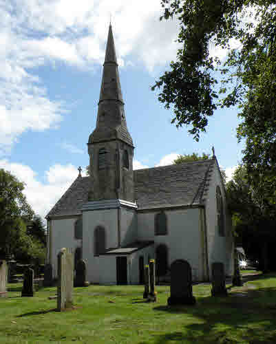
The parish of West Linton is situated in the north-west of the county of Peebles. Midlothian was located to the north of West Linton although local government reorganisation means that the northern boundary now includes West Lothian & the City of Edinburgh. The parish of Newlands is on the east and Kirkurd to the south. On the west the parish of West Linton borders on Lanarkshire. The village of Carlops which lies on the northern boundary is included in the parish. The village war memorial is in front of the church.
Old Parish Records cover the periods:
Births: 1656-1819, 1820-1855 (Mothers' names not recorded until 1702)
A Peeblesshire Miscellany - includes West Linton
Testimonials 1757-1786
Parish of West Linton Mortcloth Records 1696 - 1835
See our sales list for full details and cost of postage.
Volumes available for consultation within our Archive
County Directory of Scotland 1912 - Borders Towns and Villages
Parish Register of West Linton Associate Congregation
Parish of West Linton Mortcloth Records 1696-1835
Pre 1855 Monumental Inscriptions of Peeblesshire
Rutherford's Southern Counties Register and Directory 1867
The Whipmans Play of 2006
Magazine Articles
No articles currently.
Map of West Linton from UK Great Britain, Ordnance Survey one-inch to the mile (1:63,360), 'Hills' edition, 1885-1903 by kind permission of the National Library of Scotland. Use the control at the top left of the map to zoom in or out and drag the map left, right, up, or down as you wish.
Map of West Linton from UK Ordnance Survey Historical Maps from 1919-1947 by kind permission of the National Library of Scotland. Use the control at the top left of the map to zoom in or out and drag the map left, right, up, or down as you wish.
Other Sources
The Buildings of Scotland - Borders, Cruft, Dunbar & Fawcett, Yale University Press, London 2006
The Statistical Accounts of Scotland compiled initially between 1791 and 1799, with a subsequent edition between 1834 and 1845 are a valuable record of the geography, history, economy, people and customs recorded by local ministers. You'll need to search for the parish name.
Scottish Borders Archives, The Hub Hawick
West Linton Evening Continuation School Log Book 1895-1939 - ref: P/ED/2/37
The National Archives of Scotland
West Linton kirk session records (Ref - CH2/1304)
Collections 1716-1738, 1742
Disbursements 1716-1727
Minutes 1657-1661, 1696-1716, 1721-1728, 1730-1741, 1743-1755, 1767-1807 - with gaps
Register of Testimonials 1709-1716
Carlops Free Church
History - In 1846 a preaching station was established in the village and the congregation built a church in February 1851.
The extent of records is unknown.
West Linton Associate Congregation (Ref CH3/307)
History - In 1737, about 70 residents of the parish of West Linton left the Established Church and petitioned the Associate Presbytery for supply of minister, which was granted. They built their church in 1784.