Our archive and search room is now open on Tuesdays and Thursdays from 10am to 4pm. Keep up to date via our Facebook page and Twitter.
Lilliesleaf
Lilliesleaf Parish is situated in the north east of the County of Roxburgh being bounded on the north by the Parish of Bowden, on the east by the Parish of Ancrum, on the south by the Parishes of Minto and Wilton and on the west by the Parishes of Ashkirk and Selkirk. Lilliesleaf, along with Ancrum, Crailing and Eckford, is now part of the Ale & Teviot United parish.
Gravestone inscriptions in Lilliesleaf Churchyard have been transcribed but not yet published.
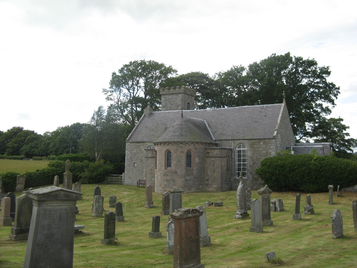
Lilliesleaf Parish Church
See our sales list for full details and cost of postage.
Volumes available for consultation within our Archive
Pre 1855 Memorial Inscriptions Lilliesleaf by William Windrum.
The Churches and Graveyards of Roxburghshire by Dr. G. A. C. Binnie 2001.
Gravestone inscriptions prior to 1855: Vol 2. Galashiels Old Cemetery, Ladhope and Bewlie Cemeteries
Rutherford's Southern Counties Register and Directory 1867.
County Directory of Scotland 1912 - Borders Towns and Villages.
CD-ROM Pigot's 1837 Directory of Berwickshire and Roxburghshire.
Lair Plan showing lair holders Lilliesleaf Cemetery 1858.
Church Magazines - Collection of Parish Magazines from 1892 to 1946 (not complete) recording births deaths and marriages and also Church minutes and Statements.
CD-ROM Land Ownership Commission Report 1872 -1873.
Magazine Articles
Please note that the heading Author includes persons who have compiled or transcribed records; and that the topics indexed, and the synopses are subjective opinions. See the Sales List to buy copies of the magazines containing articles in which you're interested.
Title
Synopsis
Size Description
Issue No
Author
Station Masters of Belses
A summary of a presentation by Mrs V. Brittain about Belses station (opened 1849) and the station master Hugh Harvey. A collection of station records from the 1880s were found.
1 page or more
15
Jed Squirrel
Voices from Lilliesleaf by Ian McDougall
Review of a book ' Voices from Lilliesleaf' by Ian MacDougall.
1 page or more
90
Old Lilliesleaf
Reminiscences and photographs of life in Lilliesleaf.
1 page or more
92
Esther Davies
A Tour through the Borders
A poem submitted by the author with other records relating to Lilliesleaf.
1 page or more
94
Esther Davis
Old Lilliesleaf, Ashkirk and Midlem
Information on a book containing old photographs relating to Lilliesleaf, Ashkirk and Midlem.
less than 1 page
98
Cousins Meet
Two distant cousins Esther Davies (the author) and Debra McConkey of Louisiana, USA, met up in 2017 and 2018, as result of the connections through membership of the Borders Family History Society. Also, the authors maiden name of Anderson brought up in Lilliesleaf, lead to the discovery of another cousin in Edinburgh (a new member Jim Dick from 2019) with roots from the Dick family in Lilliesleaf.
less than 1 page
107
Esther Davies
The Adamant McIntoshes
An account of the memorable and delayed journey of the barque "Adamant" from Gravesend, Kent to New Zealand in July 1875. Travellers included Thomas Sinclair McIntosh (1821-99 - Dunkeld, Perthshire, but possibly Lilliesleaf), who married Mary Murray (1821-1909) in Langholm, and had their 10 children in Denholm, several of which also sailed to New Zealand. Some children remained in the Borders, and in turn had children - they are listed as living in Galashiels, Southdean, Lindean, Eckford, with children. Henry Ker (joiner 24) and wife Janet of Roxburghshire also travelled on the Adamant in 1875, after their marriage in Glasgow a month earlier.
2 pages or more
109
Editor
Border-Line Experiences of a Canadian Researcher
The Ainslie born in Lilliesleaf and how a trip from Canada to research the family ended in a book.
2 pages or more
10
Robert L. Morden
Ainslies of Dolphinston to Manitoulin Island
Excellent article on the author's Ainslie forebears from Ancrum and Lilliesleaf to their arrival and life in Canada.
4 pages or more
20
Robert L P Morden
An Unexpected Homecoming
An Englishman migrates to the Borders when Riddell House changes hands. He marries a local lass with links to Innerleithen.
2 pages or more
71
David Rudram
Map of Lilliesleaf from UK Great Britain, Ordnance Survey one-inch to the mile (1:63,360), 'Hills' edition, 1885-1903 by kind permission of the National Library of Scotland. Use the control at the top left of the map to zoom in or out and drag the map left, right, up, or down as you wish.
Map of Lilliesleaf from UK Ordnance Survey Historical Maps from 1919-1947 by kind permission of the National Library of Scotland. Use the control at the top left of the map to zoom in or out and drag the map left, right, up, or down as you wish.
Other Sources
The Parish of Lilliesleaf by the Rev. Arthur Pollok Sym - Selkirk 1913.