Our archive and search room is now open on Tuesdays and Thursdays from 10am to 4pm. Keep up to date via our Facebook page and Twitter.
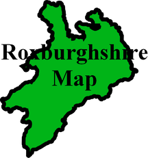
Castleton
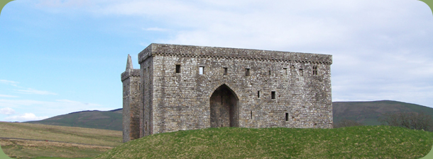
Castleton is the largest and most remote parish in Roxburghshire. It is situated in the south of the county on the border with England on the east and Dumfriesshire on the west. The Parishes of Teviothead, Kirkton, Hobkirk and Southdean & Abbotrule lie to the north. The parish lies in Liddesdale, a notorious haunt of the Border Reivers and is home to both Hermitage Castle and Liddle Castle.
The principle centre of population is Newcastleton which was built in the late 18th century to house people displaced by clearances from the original village of Castleton. It is also known as Copshaw Holm which gives it's name to the local Common Riding which has a flavour all of its own.
Another village in the parish was Riccarton Junction which for most of its existence was only accessible by rail. It existed to house railway workers who staffed a junction where a branch line to Kielder and Hexham in Northumberland left the Waverley Route between Edinburgh and Carlisle.
See our sales list for full details and cost of postage.
Volumes available for consultation within our Archive
CD Land Ownership Commission Report 1872 -1873.
CD Pigot's 1837 Directory of Berwickshire and Roxburghshire.
County Directory of Scotland 1912 - Borders Towns and Villages.
From Durisdeer and Castleton to Strachur by Innes Macleod and Margaret Maxwell - 2006.
Liddesdale - All those fine fellows by Derek Robertson 1999.
Liddesdale Monumental Inscriptions by Scottish Genealogy Society 1992.
Newcastleton bi-centenary 1793 to 1993 by Newcastleton Bicentenary Committee.
No Road this way after Dark by George Harkness - Walter Thomson, Selkirk.
Rutherford's Southern Counties Register and Directory 1867.
The Churches and Graveyards of Roxburghshire by G A C Binnie 2001.
Magazine Articles
Please note that the heading Author includes persons who have compiled or transcribed records; and that the topics indexed, and the synopses are subjective opinions. See the Sales List to buy copies of the magazines containing articles in which you're interested.
Title
Synopsis
Size Description
Issue No
Author
The Early Kyles of Castleton, Scotland
The researching of the Kyles and their history right through from the 1745 rebellion to living in Kelso in the 21st Century.
2 pages or more
39
John Murray and David Irvine
Kelso Dispensary and Castleton Poor Law Records
Some notes by the author on his publication on C.D. of Poor Law records instancing some of the information available and mentioning various diseases mentioned
1 page or more
75
Peter Munro
Local TS Royal Edward KOSB casualties
A list of KOSB casualties. (Additional names and places - William Hogg - Hawick. Also Dumfries and Galloway names - Archibald Strong - Johnstone, Francis Head Cameron - Whithorn, James Dickson + James Gordon - Kirkbean, James Kirkpatrick - Twynham, John McCaig - Port William, Joseph Hunter McMunnies - Tynwald, Joseph Melvin - Glasserton, Matthew Bryson Richardson - Lochmaben, John Telford + Robert Trodden - Annan.
1 page or more
101
Jared Squirrell
Map of Castleton from UK Great Britain, Ordnance Survey one-inch to the mile (1:63,360), 'Hills' edition, 1885-1903 by kind permission of the National Library of Scotland. Use the control at the top left of the map to zoom in or out and drag the map left, right, up, or down as you wish.
Map of Castleton from UK Ordnance Survey Historical Maps from 1919-1947 by kind permission of the National Library of Scotland. Use the control at the top left of the map to zoom in or out and drag the map left, right, up, or down as you wish.
Other Sources
Memorials of Castleton Parish by George Gilchrist, Arthur McCracken and Arthur Tolson - Annan 1971.
The Statistical Accounts of Scotland compiled initially between 1791 and 1799, with a subsequent edition between 1834 and 1845 are a valuable record of the geography, history, economy, people and customs recorded by local ministers. You'll need to search for the parish name.
Two Centuries of Borders Church Life by J Tait, Kelso, 1891.