Our archive and search room is now open on Tuesdays and Thursdays from 10am to 4pm. Keep up to date via our Facebook page and Twitter.
Hobkirk is an upland Parish in south east Roxburghshire the Parishes of Kirkton and Cavers lie to the west, the Parishes of Bedrule and Jedburgh are to the north, whilst on the east lies the Parishe of Southdean & Abbotrule, whilst on the south lies the Parish of Castleton. The principle village is Bonchester Bridge.
Hobkirk and Southdean are now linked with the Parish of Ruberslaw (a combination of the former Parishes of Bedrule and Minto).
See our sales list for full details and cost of postage.
Volumes available for consultation within our Archive
Ruleswater and its People by George Tancred - reprint 1992.
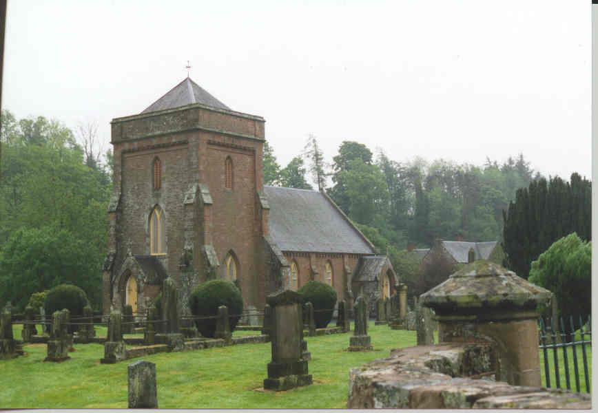
The Churches and Graveyards of Roxburghshire by Dr. G.A.C. Binnie 2001.
Rutherford's Southern Counties Register and Directory 1867.
County Directory of Scotland 1912 - Borders Towns and Villages.
CD-ROM Pigot's 1837 Directory of Berwickshire and Roxburghshire.
CD-ROM Land Ownership Commission Report 1872 -1873.
Magazine Articles
Please note that the heading Author includes persons who have compiled or transcribed records; and that the topics indexed, and the synopses are subjective opinions. See the Sales List to buy copies of the magazines containing articles in which you're interested.
Title
Synopsis
Size Description
Issue No
Author
Hobkirk/Hopkirk
Report on research into the name Hobkirk/Hopkirk.
less than 1 page
96
Glenys Bollard
Baptie Death Notices
Details of Death Notices relative to the Bapties of Hobkirk.
less than 1 page
97
Jane Stephenson
A quest for Scottish Roots in the Middle Marches
This article was first printed in the Laidlaw Family Journal of October 1995 and has been reprinted in this issue.
3 pages or more
31
Kenneth Laidlaw
Map of Hobkirk from UK Great Britain, Ordnance Survey one-inch to the mile (1:63,360), 'Hills' edition, 1885-1903 by kind permission of the National Library of Scotland. Use the control at the top left of the map to zoom in or out and drag the map left, right, up, or down as you wish.
Map of Hobkirk from UK Ordnance Survey Historical Maps from 1919-1947 by kind permission of the National Library of Scotland. Use the control at the top left of the map to zoom in or out and drag the map left, right, up, or down as you wish.
20 Most Common Surnames
The 20 most common surnames on gravestones recorded by us in the Hobkirk & Abbotrule monumental inscriptions volume are (number of gravestones in brackets): SCOTT (40), TURNBULL (38), THOMSON (20), ELLIOT (19), DOUGLAS (18), SMITH (15), BELL (13), ANDERSON (11), ARMSTRONG (11), TELFER (11), BROWN (11), AMOS (10), OLIVER (9), MACMILLAN (9), EASTON (9), MURRAY (9), TAYLOR (8), DALGLIESH (8), MINTO (7), LAIDLAW (7).
Other Sources
Annals of the Free Church of Scotland, 1843 to 1900 by the. Rev. William Ewing
contains details of the Free Church of Scotland Wolflee Congregation which served the Parishes of Southdean and Hobkirk.