Earlston is situated in the south east corner of Berwickshire being bounded on the north by the Parishes of Gordon and Hume,
on the east by the Parishes of Hume, Nenthorn, Smailholm and Merton,
on the south by the Parish of Melrose and on the west by the Parishes of Legerwood and Gordon.
Old Parish Birth Records exist from 1694 to 1854.
Marriage Records exist from 1694 to 1719 and from 1784 to 1854.
Death Records exist from 1784 to 1791.
1841 census Earlston.
1851 census Earlston.
1861 census Earlston.
Earlston Memorial Inscriptions edited by Jean Sanderson 2005
(contains Hearth Tax, Militia List, List of Ministers and transcription of the War Memorial).
Legerwood and Earlston Death Records 1784-1854 by Nigel Hardie.
See our sales list for full details and cost of postage.
Volumes available for consultation within our Archive
Pre 1855 Memorial inscriptions of Berwickshire by David Cargill.
The Churches and Churchyards of Berwickshire by G.A.C. Binnie.
C.D. The Churches and Churchyards of Berwickshire by James Robson 1896.
Index to Particular Register of Sasines for Berwickshire.
Pigot's 1837 Directory of Berwickshire and Roxburghshire.
Rutherford's Southern Counties Register and Directory 1867.
County Directory of Scotland 1912 - Borders Towns and Villages.
Magazine Articles
Please note that the heading Author includes persons who have compiled or transcribed records; and that the topics indexed, and the synopses are subjective opinions. See the Sales List to buy copies of the magazines containing articles in which you're interested.
Title
Synopsis
Size Description
Issue No
Author
Lost Earlston
Some notes on a new Earlston website.
less than 1 page
89
William Shillinglaw Crockett
Article on William Shillinglaw Crockett, Earlston, minister, poet and public speaker.
1 page or more
99
Jenny Cockburn
Andrew Currie, Border Sculptor
An account of the life of Andrew Currie, sculptor (1812-1891) born at Howford Farm Yarrow. Won commissions for several well known public monuments including Mungo Park in Selkirk, the Ettrick Shepherd at St Mary's Loch, two characters on the Scott monument in Edinburgh and Robert the Bruce at Stirling Castle. Married Isabella Hardie daughter of a Denholm stocking-maker and moved to Earlston to work as a sculptor. A full account of his life and works
5 pages or more
78
Bob Johnstone
Scott and Dickson - two blacksmith families in Earlston
An account by the author seeking to establish his ancestry from the Scott and Dickson families, blacksmiths in Earlston
1 page or more
94
Donald Straughan
Building a Business
A history of the Bunyans (Bunyies) from Melrose and Newstead from the early 1600s, originally masons from France, but moving into butcher shops, and prominence in the Melrose Town Council by George Bunyan (Bunyie - the authors' great great grandfather, and Provost of Melrose).
2 pages or more
111
Stephen Bunyan
Executions don't come cheap
An account of the hanging at Fans, Earlston of Robert Scott for the murder of two companions on their returning from a fair in the Town and the costs involved in the execution.
1 page or more
81
Ronald Morrison
Earlston Air Crash
An appeal for further information following the crash of a German bomber near Earlston during WW2.
less than 1 page
98
Ronald Morrison
Society Library
Recent additions to the Society Library.
less than 1 page
98
The Search for Catharine Gilmour
A summary of the research on Catharine Gilmour the (youngest of 3 illegitimate girls) daughter of Walter Little Gilmour of Liberton and Craigmillar b.1803, and Barbara Fraser b.1778. She was sent into the care of a shoemaker in Earlston, but her father died and her appointed legal guardian was Hugh Watson of Torsonce, as by then Walter had a legitimate male heir also named Walter, who's estate funded the girls welfare. The research also revealed history of the Newall family descendants of Robert Hogg Hawick, evidenced family in the Stow, Dryburgh and Lauder areas. Catharine ended up in Edinburgh marrying James Miller, and having a daughter Barbara, and later moving to Glasgow, and then Dunoon by 1859. Barbara moved back east to Dalkeith in the 1860s.
2 pages or more
102
Alison Macdonald
Travelling Scottish Sons from Ancrum, Crailing, Stichill and Earlston
Information extracted from the privately printed book about 3 large Border families, all of who had 1 girl who married a minister in each generations, where letters were written and kept by the brothers. The Cranstoun brothers to the Ancrum manse, the Scott brothers to the Stichill manse, and the Gordon brothers to Gordon and Earlston; the groups of brothers also kept in touch with each other. All these documents have been indexed and reflect every day life in the 1700s and early 1800s, including writing and social skills, education, professions and ministers tenures.
1 page or more
107
Colin -Miles Edgar
Anne Edgar
Map of Earlston from UK Great Britain, Ordnance Survey one-inch to the mile (1:63,360), 'Hills' edition, 1885-1903 by kind permission of the National Library of Scotland. Use the control at the top left of the map to zoom in or out and drag the map left, right, up, or down as you wish.
Map of Earlston from UK Ordnance Survey Historical Maps from 1919-1947 by kind permission of the National Library of Scotland. Use the control at the top left of the map to zoom in or out and drag the map left, right, up, or down as you wish.
20 Most Common Surnames
The 20 most common surnames on gravestones recorded by us in the Earlston monumental inscriptions volume are (number of gravestones in brackets): SCOTT (56), WILSON (39), YOUNG (33), THOMSON (33), SMITH (32), BELL (25), PRINGLE (25), KERR (24), FAIRBAIRN (24), SIMPSON (23), ROBERTSON (22), BROWN (22), TAIT (21), ANDERSON (21), HUNTER (21), DOUGLAS (21), JOHNSTON (21), WALKER (19), OLIVER (17), WHITE (15).
Other records;
The Church of Earlston 600 to 1992 by John H Duncan - Edinburgh 1992.
Scottish Borders Archive and Family History Centre, The Hub Hawick hold the following records;
Earlston School Minute Book 1873 to 1919 ref; S/ED/1/37-39.
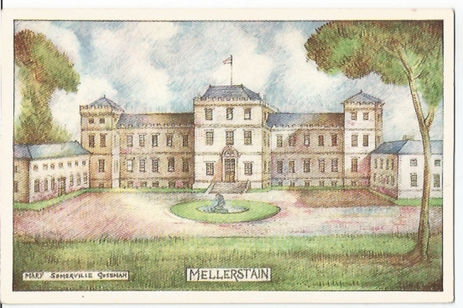
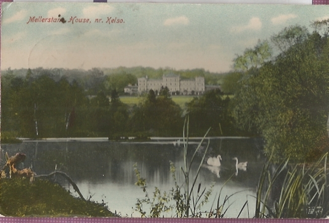
Mellerstain School Log Book 1885-1928 ref; B/ED/2/23.
Admission and Cleaning Registers ref; B/ED/3/6-7.
Earlston Chemist's Prescription Books 1911 to 1984.
The National Archives of Scotland hold the following records;
Earlston Parish Church;
Minutes 1991 to 1929 (with gaps).
Minutes 1730 to 1789.
Accounts 1736 to 1801 and 1805 to 1930 ref; CH2/857.
Earlston East General Associate Church;
Marriages 1751 to 1752.
Minutes 1751 to 1754, 1777 and 1842 to 1886.
Accounts 1777 to 1887 ref; CH3/828.
Earlston West Relief Church;
Managers' and Congregational Minutes 1839 to 1887 ref; CH3 830.
Associate Presbytery of Earlston;
Minutes 1771 to 1799 ref; CH3/106/1.
also the following MAP;
Plan of Kirklands and adjacent Park 1812 ref; - RPH. 3616.
Berwickshire Naturalists' Club has published the following articles;
Vol 1 Earlston and Thomas the Rhymer.
Vol 5 Earlston by J, Tait.
Vol 5 Earlston - the name.
Vol 8 Earlston and it Traditions by Mrs. Wood.
Vol 32 Ercildoune Tweed Mill - visited.
Vol 36 Ministers in the 17th. century.
Vol 38 Earlston Post Office.
Vol 41 Parish School.
The Southern Annual has printed the following article ;
1961 James Blaikie of Craigsford - an extraordinary man.
Websites;
First Statistical Account
by the Rev. Mr. Laurence Johnston (click "browse scanned pages and insert Parish name").
Second Statistical Account
by The Rev. David William Gordon (click "browse scanned pages and insert Parish name").
Farm Horse tax 1797-1798.
Medical Officer's of Health Reports 1891.
Land Ownership Commission Report 1872 -1873. (available on C.D. in Society Archives).
So far as we are aware, the copyright on these pictures has expired.
However, if you wish us to remove the images and you can demonstrate that you hold the copyright, please contact us.