The Parish of Eckford is in Lower Teviotdale in east Roxburghshire and includes the villages of Eckford, Eckfordmoss, Cessford, and Caverton. The Parish of Crailing lies to the west, with the Parishes of Roxburgh and Kelso to the north whilst on the east are the Parishes of Linton and Morebattle, the Parish of Hounam is on the south and the Parish of Oxnam is to the south-west.
Eckford, along with Ancrum, Crailing and Lilliesleaf, is now part of the Ale & Teviot United parish.
Roxburgh Memorial Inscriptions Vol 5 1992 edited by Elspeth Ewan - includes:
Hearth Tax Transcription
War Memorial Transcriptions
List of Ministers
2002 Reprint of Roxburgh Memorial Inscriptions edited by Elspeth Ewan.
See our sales list for full details and cost of postage.
Volumes available for consultation within our Archive
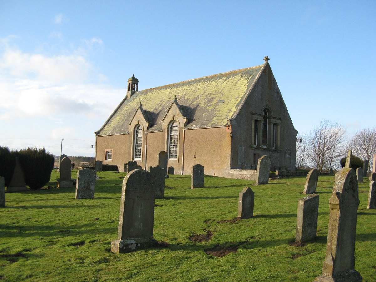
The Churches and Graveyards of Roxburghshire by Dr. G.A.C. Binnie 2001.
Rutherford's Southern Counties Register and Directory 1867.
County Directory of Scotland 1912 - Borders Towns and Villages.
CD-ROM Pigot's 1837 Directory of Berwickshire and Roxburghshire.
CD-ROM Land Ownership Commission Report 1872 -1873.
Magazine Articles
Please note that the heading Author includes persons who have compiled or transcribed records; and that the topics indexed, and the synopses are subjective opinions. See the Sales List to buy copies of the magazines containing articles in which you're interested.
Title
Synopsis
Size Description
Issue No
Author
Becton Eckford and William Wallace Eckford, Sergeants, 4th Tennessee Infantry Regt, CSA
Account of Becton Eckford and William Wallace Eckford, and their activities in the Tennessee Infantry Regt, CSA.
3 pages or more
40
Jeffry W. Gatlin
A grave look at the Borders
This must be one of the great stories ever to be printed in our magazine - it is the story of grave snatchers, and how one brave chap got his just reward.
4 pages or more
21
Ian Abernethy
Fredrick Thomas Eckford
Biography of F T Eckford,
Second Lieutenant, 12th (Green’s) Tennessee Cavalry Regt.
1 page or more
43
Jeffry W. Gatlin
Fairbairn
A modern day manipulator who could be better than a Doctor for pains. Got Rugby players who got hurt at the weekend and she would fix them up.
2 pages or more
36
kind permission of Kelso Museum
Map of Eckford from UK Great Britain, Ordnance Survey one-inch to the mile (1:63,360), 'Hills' edition, 1885-1903 by kind permission of the National Library of Scotland. Use the control at the top left of the map to zoom in or out and drag the map left, right, up, or down as you wish.
Map of Eckford from UK Ordnance Survey Historical Maps from 1919-1947 by kind permission of the National Library of Scotland. Use the control at the top left of the map to zoom in or out and drag the map left, right, up, or down as you wish.
20 Most Common Surnames
The 20 most common surnames on gravestones recorded by us in the Eckford monumental inscriptions volume are (number of gravestones in brackets): THOMSON (20), SCOTT (16), ROBSON (14), LAIDLAW (14), BROWN (14), SMITH (14), YOUNG (14), BELL (13), CAIRNS (12), GRAY (11), WOOD (11), JOHNSTON (11), CLARK (11), WILSON (10), RUTHERFORD (10), TURNBULL (10), OLIVER (10), BALMER (9), BURNS (9), TAIT (9).