Our archive and search room is now open on Tuesdays and Thursdays from 10am to 4pm. Keep up to date via our Facebook page and Twitter.
Oxnam
The Parish of Oxnam is situated on the English Border in south Roxburghshire. To the west lie the Parishes of Edgerston and Jedburgh, the Parishes of Crailing and Eckford are to the north, on the east is the Parish of Hounam, whilst lies the English County of Northumberland.
CD-ROM Roxburgh Memorial Inscriptions Vol VIII, 2008 edited by Liz Leitch - includes:
Hearth Tax Transcriptions
War Memorial Transcriptions
List of Ministers
.
See our sales list for full details and cost of postage.
Volumes available for consultation within our Archive
Ruleswater and its People by George Tancred of Wemyss 1907.
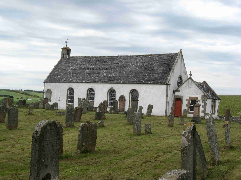
The Churches and Graveyards of Roxburghshire by Dr. G.A.C. Binnie 2001.
Rutherford's Southern Counties Register and Directory 1867.
County Directory of Scotland 1912 - Borders Towns and Villages.
CD-ROM Pigot's 1837 Directory of Berwickshire and Roxburghshire.
CD-ROM Land Ownership Commission Report 1872 -1873.
Magazine Articles
No articles currently.
Map of Oxnam from UK Great Britain, Ordnance Survey one-inch to the mile (1:63,360), 'Hills' edition, 1885-1903 by kind permission of the National Library of Scotland. Use the control at the top left of the map to zoom in or out and drag the map left, right, up, or down as you wish.
Map of Oxnam from UK Ordnance Survey Historical Maps from 1919-1947 by kind permission of the National Library of Scotland. Use the control at the top left of the map to zoom in or out and drag the map left, right, up, or down as you wish.
20 Most Common Surnames
The 20 most common surnames on gravestones recorded by us in the Oxnam monumental inscriptions volume are (number of gravestones in brackets): SCOTT (33), OLIVER (31), HALL (22), YOUNG (19), DOUGLAS (18), ELLIOT (16), BELL (16), TURNBULL (16), ROBSON (13), THOMSON (13), RUTHERFORD (12), DAVIDSON (12), BROWN (12), WYLLIE (9), SIMSON (9), PAXTON (8), SMITH (8), HUNTER (8), WILSON (8), WATSON (7).
The Statistical Accounts of Scotland compiled initially between 1791 and 1799, with a subsequent edition between 1834 and 1845 are a valuable record of the geography, history, economy, people and customs recorded by local ministers. You'll need to search for the parish name.
Two Centuries of Borders Church Life by J Tait Kelso 1891.