Legerwood is situated in the west of Berwickshire, being bounded on the north by the Parishes of Lauder and
Westruther, on the east by the Parishes of Westruther, Gordon and Earlston, on the south by the Parishes of Earlston
and Melrose and on the west by the Parishes of Melrose and Lauder.
Old Parish Birth Records exist from 1669 to 1854.
Marriage Records exist from 1690 to 1854 (with gaps).
Death records exist from 1784 to 1796 and from 1817 to 1854.
1841 census Legerwood.
1851 census Legerwood.
1861 census Legerwood.
Channelkirk and Legerwood Memorial Inscriptions Vol. 9 Berwickshire transcribed by Jean Sanderson 2003
(contains Hearth Tax, Militia List, list of ministers and War Memorial transcription).
Legerwood Death Records 1784 to 1854 transcribed by Nigel Hardie.
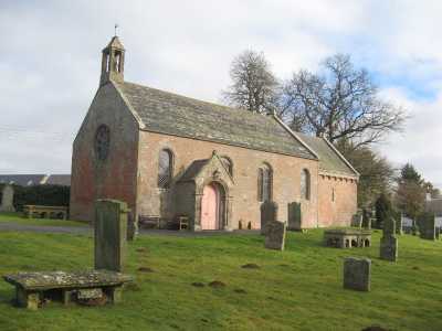
Legerwood Parish Church
See our sales list for full details and cost of postage.
Volumes available for consultation within our Archive
Legerwood Kirk published by Legerwood Church 1999.
Lauder and Lauderdale by A Thomson 2001.
Pre 1855 Memorial Inscriptions of Berwickshire by David Cargill.
Pre 1855 Memorial Inscriptions of Berwickshire by David Cargill.
The Churches and Churchyards of Berwickshire by G.A.C. Binnie.
C.D. The Churches and Churchyards of Berwickshire by James Robson 1896.
Index to Particular Register of Sasines for Berwickshire.
Pigot's 1837 Directory of Berwickshire and Roxburghshire.
Rutherford's Southern Counties Register and Directory 1867.
C.D. Slater's Directory of Berwickshire 1903.
County Directory of Scotland 1912 - Borders Towns and Villages.
Magazine Articles
No articles currently.
Map of Legerwood from UK Great Britain, Ordnance Survey one-inch to the mile (1:63,360), 'Hills' edition, 1885-1903 by kind permission of the National Library of Scotland. Use the control at the top left of the map to zoom in or out and drag the map left, right, up, or down as you wish.
Map of Legerwood from UK Ordnance Survey Historical Maps from 1919-1947 by kind permission of the National Library of Scotland. Use the control at the top left of the map to zoom in or out and drag the map left, right, up, or down as you wish.
20 Most Common Surnames
The 20 most common surnames on gravestones recorded by us in the Channelkirk and Legerwood monumental inscriptions volume are (number of gravestones in brackets): SCOTT (17), YOUNG (15), RUSSELL (13), ALLAN (11), WILSON (10), HARDIE (10), ANDERSON (10), BLAIKIE (10), SHARP (9), LOGAN (9), BROWN (9), BELL (8), SMITH (8), COCKBURN (8), ROBERTSON (7), THOMSON (7), MILLER (7), HUME (7), TAIT (7), WOOD (7).
Scottish Borders Archives and Family History Centre, The Hub Hawick hold the following records;
Legerwood Public School Log Book 1874-1964 ref; B/ED/2/30.
School Board Minute Book 1873 to 1919 ref; B/ED/1/69-70.
Writs of the lands of Legerwood and Kirklands c 1809 ref; SBA/14/1.
Kers of Moriston family papers 1526 to 1586 ref; SC/B/1.
The Scottish National Archives Edinburgh hold the following records;
Legerwood Parish Church;
Minutes 1690 and 1717 to 1935.
Collections 1689 to 1690.
Collections and Distributions 1762 to 1905.
Communion Rolls 1853 to 1899.
Proclamation Roll 1762 to 1778 and 1797 to 1818. - ref; CH2/515.
The following article has been published in the Southern Annual;
1952 A Border Kirk - Legerwood goes back a thousand years by Edwin O Hector (available in Society Archive).
Berwickshire Naturalists' Club has published the following articles;
Farm Horse tax 1797-1798.
Medical Officers of Health Reports 1891.
Land Ownership Commission Report 1872 -1873. (available on C.D. in Society Archives).
Place and Farm names in Census Records;
1841 census: Legerwood, Cambridge, Dod Mill, Dods, Boon, Boon Mill, Whitslaid, Bridge Haugh,
Kirkhill, Corsbie, Stockbridge, Deanbrae, Moriston, East Moriston, West Moriston, Addinston, Stubiwood, Birkhillside, Bridgend. 1851 census: Legerwood, Kirkhill, Corsbie, Stockbridge, East Moriston, West Moriston, Cambridge, Dodmill,
Boon, Boon Mill, Whitslaid, Bridgehaugh, Bridge End, Birkhillside, Birkenside. 1861 census: Legerwood, Kirkhill, Corsbie, Stockbridge, East Moriston, West Moriston, Cambridge, Dodmill, Boon,
Boon Mill, Whitslaid, Bridgehaugh, Bridge End, Birkhillside, Birkenside.
Population;
The population has been recorded as follows:
1755 - 398,
1801 - 495, 1811 - 560, 1821 - 476, 1831 - 565, 1841 - 571,
1851 - 587, 1861 - 599, 1881 - 558.