The Parish of Longformacus is situated in the north of Berwickshire in the Lammermuir
Hills. It is bordered on the north by the County of Midlothian, on the east by the Parishes of Abbey St. Bathans,
Duns and Langton, on the south by the Parishes of Greenlaw and Westruther and on the west by the Parish of Lauder.
Old Parish Birth Records exist from 1654 to 1854.
Marriage Records exist from 1716 to 1854.
Death records exist from 1716 to 1760.
1841 census Longformacus.
1851 census Longformacus.
1861 census Longformacus.
Longformacus Monumental Inscriptions Vol. 16 Berwickshire transcribed by
Elma Fleming (contains Hearth Tax, Militia List, list of Ministers, mortcloth records, Roll of Honour transcription and an extract from the Longformacus Public School Admission Log from 1873 to 1913, listing 424 admissions to the school, showing names of pupils and parents, addresses, occupations and dates of pupils' births). See our blog.
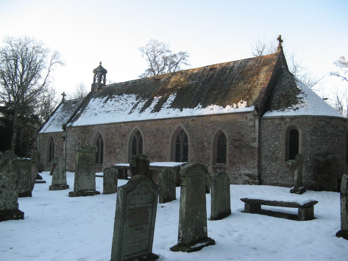
Longformacus Parish Church
See our sales list for full details and cost of postage.
Volumes available for consultation within our Archive
Pre 1855 Memorial inscriptions of Berwickshire by David Cargill.
The Churches and Churchyards of Berwickshire by G.A.C. Binnie.
C.D. The Churches and Churchyards of Berwickshire by James Robson 1896.
Glimpses into the Past in Lammermuir by Norrie McLeish.
Index to Particular Register of Sasines for Berwickshire.
Pigot's 1837 Directory of Berwickshire and Roxburghshire.
Rutherford's Southern Counties Register and Directory 1867.
C.D. Slater's Directory of Berwickshire 1903.
County Directory of Scotland 1912 - Borders Towns and Villages.
Magazine Articles
Please note that the heading Author includes persons who have compiled or transcribed records; and that the topics indexed, and the synopses are subjective opinions. See the Sales List to buy copies of the magazines containing articles in which you're interested.
Title
Synopsis
Size Description
Issue No
Author
Know your parish - Longformacus
The history, and how Longformacus got its name. Its population and parish records.
1 page or more
21
Editor
Longformacus Free Church
Discovery of a poem written in 1869 relating to Longformacus Free Church.
2 pages or more
91
Longformacus and Lammermuir Heritage Centre
Notes on the newly opened Longformacus and Lammermuir Heritage Centre.
less than 1 page
94
Abbey St Bathans, Cranshaws and Longformacus
A brief description of 3 neighbouring parishes and the records available.
2 pages or more
73
The Berwickshire Leitchs Part 3
A continuation of the Parts 1 and 2 of the Berwickshire Leitchs (Issues 105 and 106). Further investigating the possible older sons of James Leitch (1800-1880). Matthew was born in Fogo (b. 1851), moving to Greenlaw and then Clockmill, Duns with his parents, and then to High Street Langton marrying Elizabeth Calder and having 6 children. Later, he and brother David (the pharmacist) inherited the family home in Greenlaw, which they tried to let out. Matthew died in Longformacus, but his sons James and John continued as stone dykers, but James joined the Kings own Scottish Borderers and died in 1915 at Gallipoli. Son John stayed in Longformacus and his sons Matthew and Robert taking part in WW2. The tracing goes on trying to establish the history of Matthews older half brothers. The trail becomes complicated.
2 pages or more
107
Diana Leitch
To Follow the Dogs and Carry the Stick
An account of life and shepherding in the Lammermuirs before, during and immediately after the Second World War.
1 page or more
90
Bob Jaffray
Poor Relief in the 1840s
A review of the operation of the poor relief in the early 19th century. It includes the size of the allowances paid and an estimate of the cost of living at the time.
4 pages or more
71
Peter Munro
Longformacus
A cautionary tale from 1871 and some extracts from the school log book,
2 pages or more
73
Brown's Self Interpreting Family Bible
George Brown of Horncliffe brought into the offices the very large Brown family bible. Lavishly illustrated, it also included Family Register page. A transcript of the text is presented. It includes members of the Robertson family from Alexander Robertson (b. 1829 in Simperon Mains) and his wife Margaret (b. 1825 in Swinton) through to Georgina Dickson Robertson and Mary Dickson Robertson born in 1871 in Monkerstones, Fogo. All names registered were from the Borders. Research has confirmed more of the family up to the George Brown who donated the bible.
less than 1 page
110
Editor
Map of Longformacus from UK Great Britain, Ordnance Survey one-inch to the mile (1:63,360), 'Hills' edition, 1885-1903 by kind permission of the National Library of Scotland. Use the control at the top left of the map to zoom in or out and drag the map left, right, up, or down as you wish.
Map of Longformacus from UK Ordnance Survey Historical Maps from 1919-1947 by kind permission of the National Library of Scotland. Use the control at the top left of the map to zoom in or out and drag the map left, right, up, or down as you wish.
20 Most Common Surnames
The 20 most common surnames on gravestones recorded by us in the Longformacus monumental inscriptions volume are (number of gravestones in brackets): BROWN (21), WILSON (8), CRAIK (7), FORTUNE (7), SCOTT (6), SMITH (6), ANDERSON (6), PURVES (5), PATERSON (5), ELLIOT (5), BUCKHAM (5), MACK (4), TAIT (4), TURNBULL (4), RANKIN (4), THOMSON (4), MOFFAT (4), MILLER (4), JOHNSTON (4), TROTTER (4).
Other Sources;
Scottish Borders Archives and Family History Centre, The Hub Hawick hold the following records;
Longformacus School Admission register 1874 to 1962 ref; B/ED/3/5.
School Board Minute Books 1873 to 1919 ref; B/ED/1/71-72.
School Log Book Admission Registers etc. 1913 to 1991 ref; B/ED/16/1-5.
Scottish National Archives Edinburgh hold the following records;
Longformacus Parish Church;
1. Minutes 1684-1711.
2. Accounts and Minutes 1715-1734, 1776-1796 with gaps.
3. Accounts 1734 to-1864.
4. Births 1855 -1861 - ref; - CH2/250.
Longformacus Free Church;
1. Session Minutes 1848-1930.
2. Committee and Deacons' Court Book 1845-1941.
3. Account Books from 1845 to 1931.
4. Births 1876 to 1889. - ref; -CH3/221.
Berwickshire Naturalists' Club has published the following articles;
Vol. 10 Longformacus - the name.
Vol. 10 Longformacus House.
Vol. 34 Manor and its owners by Miss H. M. Brown.
Vol. 37 Horseupcleuch- graves of 2 Cromwellian Soldiers.