Westruther lies in southern slopes of the Lammermuir Hills in western Berwickshire being bounded on the north by the Parish of Longformacus, on the east by the Parishes
of Longformacus, Greenlaw and Gordon, on the south by the Parishes of Gordon and Legerwood and on the east by the Parish of Lauder.
Old Parish Birth Records exist from 1657 to 1854.
Marriage Records from 1658 to 1854.
There are no death records.
1841 census Westruther.
1851 census Westruther.
1861 census Westruther.
Gordon, Nenthorn and Westruther Memorial Inscriptions edited by Elspeth Ewan
1999 (contains Hearth Tax, Militia List, List of Ministers and transcription of
the War Memorial).
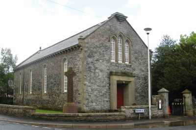
Westruther Parish Church
See our sales list for full details and cost of postage.
Volumes available for consultation within our Archive
Pre 1855 Memorial inscriptions of Berwickshire by David Cargill.
The Churches and Churchyards of Berwickshire by G.A.C. Binnie.
CD The Churches and Churchyards of Berwickshire by James Robson 1896.
Index to Particular Register of Sasines for Berwickshire.
Pigot's 1837 Directory of Berwickshire and Roxburghshire.
Rutherford's Southern Counties Register and Directory 1867.
CD Slater's Directory of Berwickshire 1903.
County Directory of Scotland 1912 - Borders Towns and Villages.
Magazine Articles;
Please note that the heading Author includes persons who have compiled or transcribed records; and that the topics indexed, and the synopses are subjective opinions. See the Sales List to buy copies of the magazines containing articles in which you're interested.
Title
Synopsis
Size Description
Issue No
Author
Lady Jane Scott-Spottiswoode
Reference to a pamphlet 'Souvenir of Sympathy' donated to the Society relating to the funeral of Lady Jane Scott-Spottiswoode.
1 page or more
95
Ronald Morrison
The Gladstones: A study
This is a brief outline of the Gladstone family here in the Borders and as far away as Edinburgh, and Norwich.
3 pages or more
35
G.M.S. Lauder-Frost
Map of Westruther from UK Great Britain, Ordnance Survey one-inch to the mile (1:63,360), 'Hills' edition, 1885-1903 by kind permission of the National Library of Scotland. Use the control at the top left of the map to zoom in or out and drag the map left, right, up, or down as you wish.
Map of Westruther from UK Ordnance Survey Historical Maps from 1919-1947 by kind permission of the National Library of Scotland. Use the control at the top left of the map to zoom in or out and drag the map left, right, up, or down as you wish.
20 Most Common Surnames
The 20 most common surnames on gravestones recorded by us in the Gordon, Nenthorn, & Westruther monumental inscriptions volume are (number of gravestones in brackets): HENDERSON (51), SCOTT (33), WOOD (24), ROBERTSON (22), MCDOUGAL (22), WILSON (22), PURVES (20), ALLAN (19), HOGARTH (19), BROWN (18), MURRAY (18), GIBSON (18), ANDERSON (17), WALDIE (17), JOHNSTON (17), HUNTER (17), PRINGLE (17), TROTTER (16), HAY (16), SMITH (16).
Other Sources;
Spottiswoode - Life and Labour on a Berwickshire Estate 1753 to 1793 by Tom Barry and
Douglas Hall - 1993.
Scottish Borders Council and Family History Centre, The Hub Hawick hold the following records;
Westruther Public School Log Book 1873 to 1898 ref; B/ED/2/63.
Westruther Continuation School Log Book 1895 to 1898 ref; B/ED/2/63.
Pyatshaw School Log Books 1933 to 1966. ref; B/ED/2/5.
The National Archives of Scotland hold the following records;
Westruther Parish Church;
Minutes 1655, 1659 to 1660, 1678 to 1682 and 1704 to 1930.
The Statistical Accounts of Scotland compiled initially between 1791 and 1799, with a subsequent edition between 1834 and 1845 are a valuable record of the geography, history, economy, people and customs recorded by local ministers. You'll need to search for the parish name.
RCHAMS website Scotland's Places contains details of;
Farm Horse tax 1797-1798.
Medical Officers of Health Reports 1891.
Land Ownership Commission Report 1872 -1873. (available on C.D. in Society Archives).