This website uses cookies. To read more about them, click 'cookies stored'. To accept our cookies, click the check box then press 'Continue'.

| Us |
|
|
Parishes |
|
Websites |
|
On |
|
Our archive and search room is now open on Tuesdays and Thursdays from 10am to 4pm. Keep up to date via our Facebook page and Twitter.
|
Yarrow is situated in north Selkirkshire being bounded on the west and north by the parishes of Tweedsmuir, Peebles, Traquair and Innerleithen in Peeblesshire, on the east by the parishes of Caddonfoot and Selkirk and on the south by the parishes of Kirkhope and Ettrick.
Sales List
|
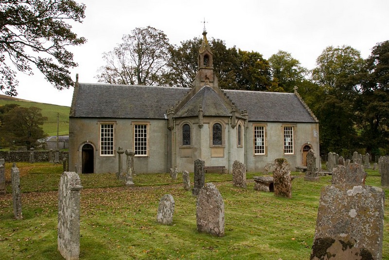
Yarrow Parish Church
 |
See our sales list for full details and cost of postage.
Please note that the heading Author includes persons who have compiled or transcribed records; and that the topics indexed, and the synopses are subjective opinions.
See the Sales List to buy copies of the magazines containing articles in which you're interested.
| Title | Synopsis | Size Description | Issue No | Author |
|---|---|---|---|---|
| Know your Parish: Yarrow | A journey down through the Yarrow valley from top to bottom | 1 page or more | 32 | Audrey Mitchell |
| An Elephantine trip to St Mary's Loch | George Reavly in his history of Galashiels notes that fifty years ago not a gig could be got to hire. One of the largest trips that ever left Galashiels propelled by horse power. On the trip to St Marys Loch. | 2 pages or more | 22 | K. McRae |
| William Welsh - The Dowie Dens o' Yarrow | Some notes on William Welsh author of a book of poetry in 1838 and on the origins of the Ballad 'The Dowie Dens of Yarrow'. | 1 page or more | 81 | Ronald Morrison |
| A History of the Brydons | For some hundreds of years there has been Brydons in the Borders. From Gilston, Broadmeadows, and overseas. | 2 pages or more | 7 | Mrs Joan Scott Stewart |
| The mole catchers of Lilliesleaf | The story of a mole and rabbit catcher in the Lilliesleaf area. | 1 page or more | 18 | Mrs S.J. Hodgkinson |
| A Canadian Connection | Copies of letters sent from Canada in 1864 - they make very interesting reading. | 2 pages or more | 25 | Jenifer Payne |
| Why couldn�t he have been called Ebenezer ? | Article examining which John Little is the author's ancestor. | 4 pages or more | 42 | Jessie Hislop |
| Dalgleishs and Stoddarts of Yarrow | Description of George McLauchlan's family from his paternal great grandparents Robert Dalgleish and Margaret Elliot from Yarrow, and Robert's step-family John Stoddart. The Dalgleish family were tenants at Fastheugh for over 100 years, and Robert's parents (Robert and Martha Muir were from Anaston. Martha married 3 times - Robert, John Stoddart (Williamhope) and Robert Curror (Hartwoodburn). Margaret Elliot was a direct descendant of Martin Elliot of Braidley. John and Martha had 3 children; John later married Helen Veitch (Innerleithen) and had 9 children. | 2 pages or more | 103 | Marjorie McLauchlan |
Map of Yarrow from UK Great Britain, Ordnance Survey one-inch to the mile (1:63,360), 'Hills' edition, 1885-1903
by kind permission of the National Library of Scotland.
Use the control at the top left of the map to zoom in or out and drag the map left, right, up, or down as you wish.
Map of Yarrow from UK Ordnance Survey Historical Maps from 1919-1947
by kind permission of the National Library of Scotland.
Use the control at the top left of the map to zoom in or out and drag the map left, right, up, or down as you wish.
The 20 most common surnames on gravestones recorded by us in the Yarrow monumental inscriptions volume are (number of gravestones in brackets): Scott (47), Anderson (22), Hogg (20), Laidlaw (18), Turnbull (16), Mitchell (16), Nichol (13), Little (12), Brown (12), Johnstone (12), Renwick (11), Brydon (10), Amos (10), Dalgleish (10), Goodfellow (9), Beattie (9), Baptie (9), Henderson (9), Douglas (8), Wilson (8).
1841 census: Adinhope, Altrive Lake, Ashisteel, Berrybush, Birks, Blackhouse, Bowerhope, Brockhill, Cathaugh, Catslackburn, Catslacknow, Craig Douglas, Craighope, Crosscleuch, Cutkerwood, Dodhead, Drycleughlee, Dryhope, East Deuchar, East Redfordgreen, Elybank, Ettrickbridge Village, Fanns, Fauldshope, Gilmanscleugh, Goldisgreen, Gordon Inn, Haningshaw, Helmburn, Hennel, Howfoord, Howford, Huntly, Huttlerburn, Hydhope, Kirkhope, Kirkstead, Ladhope, Langhope, Lewinshope, Linfoot, Lower Huntly, Mt.Benger, Muttonhall, Nether Delorain Upper Delorain, Newbrough, Newhouse, Old Lewinshope, Peel, Sandbed, Shaws, Shiringscleugh, Shootenlees, Singly, St.Marys Cottage, Stenhopefoot, Sundhope, Sundhopeburn, Sundhopehead, Tinnis, West Deuchar, West Redfordgreen, Whitefield, Whitehope, Whitelshiell, Whithillbrea, Woodend, Yarrow Feu,Yarrow Peelburn Head, Yarrowford Village.
1851 census: Altrieve, Ashisteel, Berrybush, Birks, Bourhop, Brockhill, Cathaugh, Catslackburn, Catslacknow Village, Craig Douglas, Crosscleugh, Cutkerwood, Deuchar, Dodhead, Drycleuchlee, Dryhop, East Kershope, Eldinhope, Elibank, Ettrickbridge Village, Fanns, Fauldshope, Gilmanscleuch, Goldiesgreen, Hangingshaw, Hart Leap, Helmburn, Hennel, Hillend, Howford, Huntly, Hutlerburn, Hyndhope, Inch, Kirkhope, Kirkstead, Ladhope, Langhope, Lewinshope, Mt.Benger, Mutton Hall, Nether Deolraine, Newburgh, Newousehouse, Old Howford, Old Lewinshope, Over Deolraine, Rabbit Hall, Redfordgreen, Shaws, Sherengscleuch, Singlee, St Marys Ct., Stenhopefoot, Sundhope, Tinnis, West Kershope, Whitefield, Whitehope, Whithillbrae, Whithillshiel, Woodend,Yarrow Peelburnhead, Yarrowford Village.
1861 census: Altrieve, Ashiesteel, Berrybush, Birks, Blackhouse, Bowehope, Carleton, Catslackburn, Craig of Douglas, Crooscleugh, Dryhope, Duchermill, East Kershope, Eldinhope, Elibank, Feus, Glengaber, Gordon Arms, Greenwells, Haningshaw, Hartleap, Hennel, Howford, Kirkstead, Ladhope, Lewinshope, Mountbenger, Muttonhall, Peel, Sandbed, Scar Neuk, Sundhope, Sunny Bank, The Plantain, Tinnis, Town Head, Warrior's Rest, West Kershope, Whitehope, Yarowford Village, Yarrow
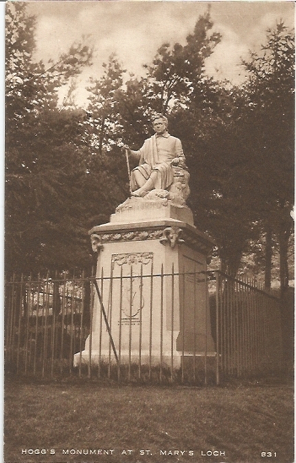
James Hogg Monument, St Mary's Loch (before 1939)
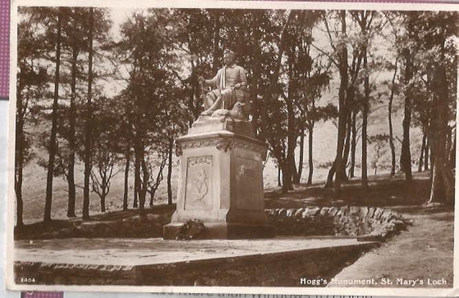
James Hogg Monument, St Mary's Loch
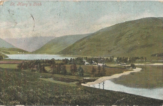
St Mary's Loch (before 1906)
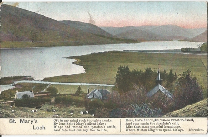
St Mary's Loch (before 1906)
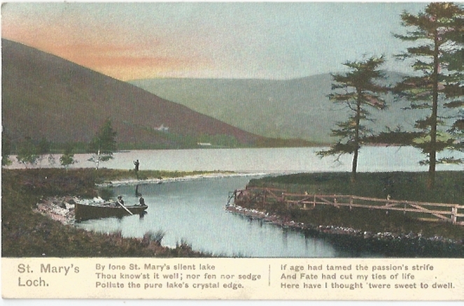
St Mary's Loch (before 1906)
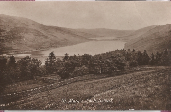
St Mary's Loch
So far as we are aware, the copyright on these pictures has expired.
However, if you wish us to remove the images and you can demonstrate that you hold the copyright, please contact us.