Our archive and search room is now open on Tuesdays and Thursdays from 10am to 4pm. Keep up to date via our Facebook page and Twitter.
Ashkirk
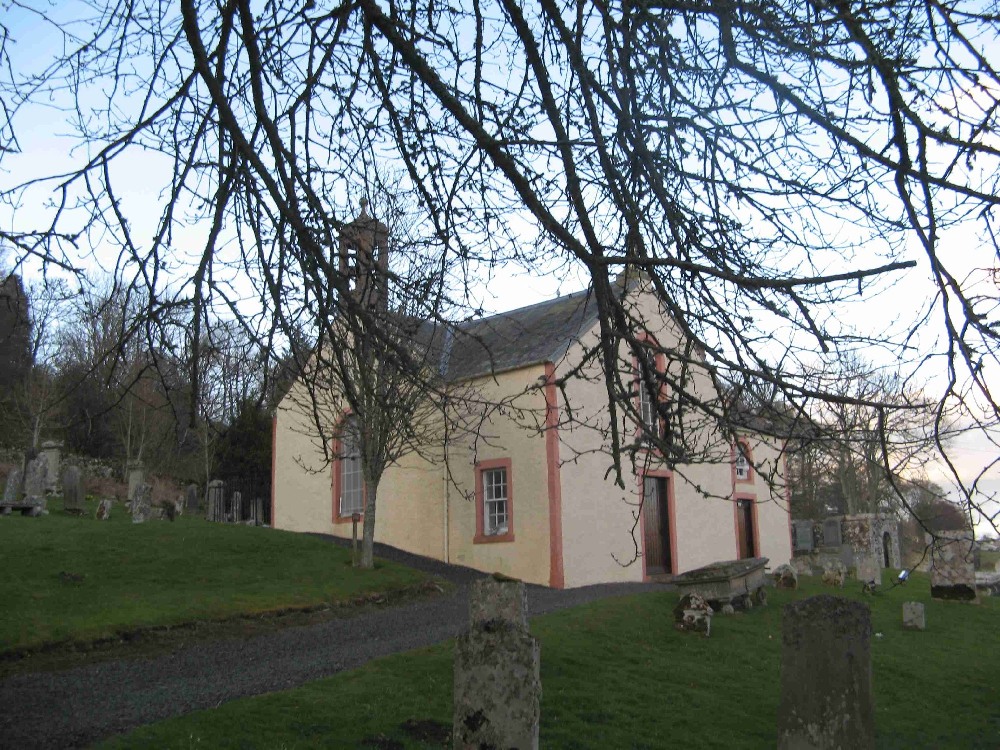
Ashkirk is situated in east Roxburghshire being bounded on the on the east by the Parishes of Lilliesleaf and Wilton, on the south by the Parish of Roberton, on the south-west by the Parish of Kirkhope and on the north-west by the Parish of Selkirk all in Selkirkshire. The parish straddles the boundary between the former counties of Roxburgh and Selkirk. The parish is now linked with Selkirk
See our sales list for full details and cost of postage.
Volumes available for consultation within our Archive
Ashkirk pre. 1855 Memorial Inscription transcribed by The Selkirk Antiquarian Society, 1969.
The Churches and Graveyards of Roxburghshire by Dr. G. A. C. Binnie 2001.
Rutherford's Southern Counties Register and Directory 1867.
County Directory of Scotland 1912 - Borders Towns and Villages.
Ashkirk and its Monumental Inscriptions - Hawick Archaeological Society, 1962.
Ashkirk Old and New: Ghosts and Green Pastures - The Southern Annual, 1957.
CD-ROM Pigot's 1837 Directory of Berwickshire and Roxburghshire.
CD-ROM Land Ownership Commission Report 1872 -1873.
Magazine Articles;
Please note that the heading Author includes persons who have compiled or transcribed records; and that the topics indexed, and the synopses are subjective opinions. See the Sales List to buy copies of the magazines containing articles in which you're interested.
Title
Synopsis
Size Description
Issue No
Author
Old Lilliesleaf, Ashkirk and Midlem
Information on a book containing old photographs relating to Lilliesleaf, Ashkirk and Midlem.
less than 1 page
98
James Hogg Ancestry
Report of research to establish a family connection with James Hogg, the Ettrick Shepherd,
1 page or more
98
Mike Hogg
Map of Ashkirk from UK Great Britain, Ordnance Survey one-inch to the mile (1:63,360), 'Hills' edition, 1885-1903 by kind permission of the National Library of Scotland. Use the control at the top left of the map to zoom in or out and drag the map left, right, up, or down as you wish.
Map of Ashkirk from UK Ordnance Survey Historical Maps from 1919-1947 by kind permission of the National Library of Scotland. Use the control at the top left of the map to zoom in or out and drag the map left, right, up, or down as you wish.
20 Most Common Surnames
The 20 most common surnames on gravestones recorded by us in the Ashkirk monumental inscriptions volume are (number of gravestones in brackets): SCOTT (58), HENDERSON (15), ELLIOT (14), BELL (10), THOMSON (10), JACKSON (9), DUNLOP (8), GRAY (8), BROWN (8), ANDERSON (8), GRIEVE (8), MURRAY (7), DOUGLAS (7), HOGG (7), OGILVIE (7), TURNBULL (6), OLIVER (6), ARMSTRONG (6), WILSON (6), LAIDLAW (5).