Our archive and search room is now open on Tuesdays and Thursdays from 10am to 4pm. Keep up to date via our Facebook page and Twitter.
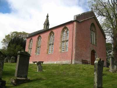
Channelkirk
The Parish of Channelkirk lies in the north west corner of Berwickshire, with the County of Midlothian to the north and north-west, the Parish of Lauder lies to the east, the Parish of Stow formerly in the County of Midlothian but now in the Scottish Borders lies to the south.
Channelkirk Death Records transcribed by Nigel Hardie.
Channelkirk and Legerwood Memorial Inscriptions, Volume 9 Berwickshire, edited by Jean Sanderson, 2003 - includes:
Hearth Tax
Militia List
List of Ministers
Transcription of the War Memorial)
See our sales list for full details and cost of postage.
Volumes available for consultation within our Archive
Pre 1855 Memorial Inscriptions of Berwickshire by David Cargill.
The Churches and Churchyards of Berwickshire by G.A.C. Binnie.1995.
Index to Particular Register of Sasines for Berwickshire.
Rutherford's Southern Counties Register and Directory 1867.
County Directory of Scotland 1912 - Borders Towns and Villages.
Pigot's 1837 Directory of Berwickshire and Roxburghshire.
CD-ROM The Churches and Churchyards of Berwickshire by James Robson 1896.
1957 Memories of Oxton, G. R. Knight. (The Southern Annual, 1957)
CD-ROM Slater's Directory of Berwickshire 1903.
CD-ROM Land Ownership Commission Report 1872 -1873.
Magazine Articles
Please note that the heading Author includes persons who have compiled or transcribed records; and that the topics indexed, and the synopses are subjective opinions. See the Sales List to buy copies of the magazines containing articles in which you're interested.
Title
Synopsis
Size Description
Issue No
Author
Lauder and Lauderdale
This is the text of the talk given by Ian Miller, president of Old Gala House on the 18th April 1999
5 pages or more
41
Ian Miller
A Nostalgic Visit to Lauder and Channelkirk
A report of the author's return from South Africa, his attendance at a late night Church service in Lauder, the erection of a plaque and his family connections with the area.
3 pages or more
82
Prof. Charles Wait
Pte John Donaldson Scott
An investigation into the life of John Donaldson Scott, killed in France in 1914.
2 pages or more
97
John Simpson Barton
Map of Channelkirk from UK Great Britain, Ordnance Survey one-inch to the mile (1:63,360), 'Hills' edition, 1885-1903 by kind permission of the National Library of Scotland. Use the control at the top left of the map to zoom in or out and drag the map left, right, up, or down as you wish.
Map of Channelkirk from UK Ordnance Survey Historical Maps from 1919-1947 by kind permission of the National Library of Scotland. Use the control at the top left of the map to zoom in or out and drag the map left, right, up, or down as you wish.
20 Most Common Surnames
The 20 most common surnames on gravestones recorded by us in the Channelkirk and Legerwood monumental inscriptions volume are (number of gravestones in brackets): SCOTT (17), YOUNG (15), RUSSELL (13), ALLAN (11), WILSON (10), HARDIE (10), ANDERSON (10), BLAIKIE (10), SHARP (9), LOGAN (9), BROWN (9), BELL (8), SMITH (8), COCKBURN (8), ROBERTSON (7), THOMSON (7), MILLER (7), HUME (7), TAIT (7), WOOD (7).
Other Sources
The Statistical Accounts of Scotland 1791-99 vol.13 p.384: Channelkirk, County of Berwick (click "browse scanned pages" and insert Parish name)
The Statistical Accounts of Scotland 1834-45 vol.2 p.88: Channelkirk, County of Berwick (click "browse scanned pages" and insert Parish name)