Our archive and search room is now open on Tuesdays and Thursdays from 10am to 4pm. Keep up to date via our Facebook page and Twitter.
Foulden
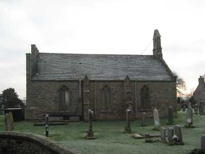
Foulden is situated in the south east corner of Berwickshire with the Parish of Ayton to the north by, the Parish of Mordington to the east, the Parish of Hutton is on the south and the Parish of Chirnside is on the west.
Foulden and Lamberton Memorial Inscriptions edited by Elspeth Ewan 1995 - includes:
Hearth Tax
Militia List
List of Ministers
War Memorial transcription
Parish of Foulden Burials 1817 to 1854 transcribed by Nigel Hardie.
See our sales list for full details and cost of postage.
Volumes available for consultation within our Archive
Smallholding Memories published by Foulden Community Council.
Pre 1855 Memorial Inscriptions of Berwickshire by David Cargill.
The Churches and Churchyards of Berwickshire by G A C Binnie.1995.
Index to Particular Register of Sasines for Berwickshire.
Rutherford's Southern Counties Register and Directory 1867.
County Directory of Scotland 1912 - Borders Towns and Villages.
Foulden Manse by Peter Daniel (Berwickshire Naturalists' Society Vol. 50).
Foulden, Church and Tithe Barn by G A C Binnie (Berwickshire Naturalists' Society Vol. 50).
CD The Churches and Churchyards of Berwickshire by James Robson 1896.
CD Slater's Directory of Berwickshire 1903.
CD Land Ownership Commission Report 1872 -1873.
Magazine Articles;
Please note that the heading Author includes persons who have compiled or transcribed records; and that the topics indexed, and the synopses are subjective opinions. See the Sales List to buy copies of the magazines containing articles in which you're interested.
Title
Synopsis
Size Description
Issue No
Author
Smallholdings at Foulden, Mordington and Lamberton
A summary of Brian Patten�s talk on 17th March 2002.
3 pages or more
49
Brian Patten
Farms And Smallholdings at Foulden - 1920-21
Transcription of Valuation Rolls for Foulden
1 page or more
50
Brian Patten
A walk around Foulden in the thirties and forties
The following article was written by Jean Greenland for her granddaughters. She lived in the Manse at Foulden and travelled mostly on foot to all the surrounding area with her parents. Very good.
2 pages or more
32
Jean Greenland
Mentions of the Ramsays of Foulden family
An account of the history of the Ramsays of Foulden in Berwickshire from the 13th century
2 pages or more
92
Gregory Lauder-Frost
Map of Foulden from UK Great Britain, Ordnance Survey one-inch to the mile (1:63,360), 'Hills' edition, 1885-1903 by kind permission of the National Library of Scotland. Use the control at the top left of the map to zoom in or out and drag the map left, right, up, or down as you wish.
Map of Foulden from UK Ordnance Survey Historical Maps from 1919-1947 by kind permission of the National Library of Scotland. Use the control at the top left of the map to zoom in or out and drag the map left, right, up, or down as you wish.
20 Most Common Surnames
The 20 most common surnames on gravestones recorded by us in the Foulden and Mordington monumental inscriptions volume are (number of gravestones in brackets): MURRAY (31), WILSON (22), RENTON (17), PURVES (17), SCOTT (15), JEFFREY (14), SMITH (13), WOOD (11), JOHNSTON (10), COWE (10), PATERSON (10), PATTERSON (8), DARLING (8), BROWN (8), THOMPSON (7), ANDERSON (7), DAVIDSON (7), MILLER (7), CRAIG (7), COCKBURN (7).
Other Sources
Smallholding Memories by Foulden Mordington and Lamberton Community Council 2000.
The Statistical Accounts of Scotland 1791-99 vol.11 p.116: Foulden, County of Berwick (click "browse scanned pages" and insert Parish name)
The Statistical Accounts of Scotland 1834-45 vol.2 p.261: Foulden, County of Berwick (click "browse scanned pages" and insert Parish name)