Our archive and search room is now open on Tuesdays and Thursdays from 10am to 4pm. Keep up to date via our Facebook page and Twitter.
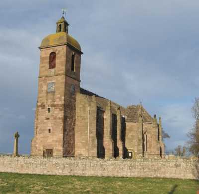
Ladykirk
Ladykirk, previously known as Upsettlington, is situated in south east Berwickshire on the border with England. The Parish of Whitsome is to the north, the Parish of Hutton lies to the east, the English County of Northumberland is on the south and the Parish of Swinton & Simprim lies to the west.
Only pre 1855 memorial records have been transcribed (see below).
See our sales list for full details and cost of postage.
Volumes available for consultation within our Archive
Pre 1855 Memorial Inscriptions of Berwickshire by David Cargill.
The Churches and Churchyards of Berwickshire by G.A.C. Binnie.1995.
Index to Particular Register of Sasines for Berwickshire.
Rutherford's Southern Counties Register and Directory 1867.
County Directory of Scotland 1912 - Borders Towns and Villages.
Pigot's 1837 Directory of Berwickshire and Roxburghshire.
CD-ROM The Churches and Churchyards of Berwickshire by James Robson 1896.
CD-ROM Slater's Directory of Berwickshire 1903.
CD-ROM Land Ownership Commission Report 1872 -1873.
Magazine Articles
Please note that the heading Author includes persons who have compiled or transcribed records; and that the topics indexed, and the synopses are subjective opinions. See the Sales List to buy copies of the magazines containing articles in which you're interested.
Title
Synopsis
Size Description
Issue No
Author
Bygone Days
This is the text of Eleanor's fascinating talk on Upsettlington (also known as Ladykirk) from the 12th century onwards, given to the Society on 19th October 2003.
3 pages or more
54
Eleanor Moffat
William Elliot, Architect
The family history of William Elliot and descriptions of some of the fine house's he built.
3 pages or more
15
Kathleen Stewart
Hand Fasting May
An account of how a couple became engaged by hand fasting on May morning.
2 pages or more
99
Patricia Paterson
Map of Ladykirk from UK Great Britain, Ordnance Survey one-inch to the mile (1:63,360), 'Hills' edition, 1885-1903 by kind permission of the National Library of Scotland. Use the control at the top left of the map to zoom in or out and drag the map left, right, up, or down as you wish.
Map of Ladykirk from UK Ordnance Survey Historical Maps from 1919-1947 by kind permission of the National Library of Scotland. Use the control at the top left of the map to zoom in or out and drag the map left, right, up, or down as you wish.
Other Sources
The Statistical Accounts of Scotland 1791-99 vol.8 p.71: Ladykirk, County of Berwick (click "browse scanned pages" and insert Parish name)
The Statistical Accounts of Scotland 1834-45 vol.2 p.181: Ladykirk, County of Berwick (click "browse scanned pages" and insert Parish name)
1841 census: Ladykirk, New Ladykirk, Old Lady, Upsett, Ramrig, Wester Fellow Hills, Horden.
1851 census: Ladykirk, Walter Stead, Upsettlington, Shiels, Smiddy Green, Old Ladykirk, Horndean Bank, Horndean, New Horndean, Foleyhills, Ranrig, Ramrig, New Ladykirk.
1861 census: Ladykirk, Greenside, Ramrig, Foleyhills, New Horndean, Horndean, Upsettlington, Ladykirk Shiels, Walter Stead.