The joint Parishes of Swinton and Simprim (united in 1761) are situated in the south east of Berwickshire,
being bounded on the north by the Parishes of Edrom and Whitsome, on the east by the Parish of Ladykirk, on the south by the
Parish of Coldstream and on the east by the Parishes of Eccles and Fogo.
Old Parish Birth Records exist from 1668 to 1674 and from 1700 to 1854.
Marriage Records exist from 1698 to 1717 and from 1769 to 1854.
Death records exist from 1697 to 1719 and from1769 to 1841.
1841 census Swinton.
1851 census Swinton.
1861 census Swinton.
The Monumental Inscriptions have not been transcribed except as below.
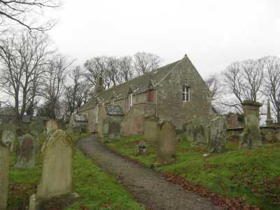
Swinton Parish Church
See our sales list for full details and cost of postage.
Volumes available for consultation within our Archive
Pre 1855 Memorial inscriptions of Berwickshire by David Cargill.
The Churches and Churchyards of Berwickshire by G.A.C. Binnie.
C.D. The Churches and Churchyards of Berwickshire by James Robson 1896.
Trotter of Prentonan by George Baird Trotter.
Index to Particular Register of Sasines for Berwickshire.
Pigot's 1837 Directory of Berwickshire and Roxburghshire.
Rutherford's Southern Counties Register and Directory 1867.
C.D. Slater's Directory of Berwickshire 1903.
County Directory of Scotland 1912 - Borders Towns and Villages.
Magazine Articles;
Please note that the heading Author includes persons who have compiled or transcribed records; and that the topics indexed, and the synopses are subjective opinions. See the Sales List to buy copies of the magazines containing articles in which you're interested.
Title
Synopsis
Size Description
Issue No
Author
Swinton Memorial Inscriptions
A mention of the transcription of the Memorial Inscriptions at Swinton Churchyard recently carried out by Coldstream History Society and developments at Lennel Churchyard.
less than 1 page
94
James Melrose Scott
Further to a request for information on Margaret B Scott (1874-1953) in Issue 108, more information is included from member Bruce McCartney regarding James Melrose Scott, Margaret's brother. He joined the KOSB July 1888 and died at Loos August 1915 as a sergeant in WW1, leaving a widow Louisa Selina (Hamilton) Scott of Halliburton Place, Galashiels, and 2 adopted daughters, known as Isabella Melrose, and Agnes Scott. Piper Daniel Laidlaw of Swinton, was later awarded the Victoria Cross for conspicuous bravery playing the company out of the gassed trench.
less than 1 page
109
Editor
Brown's Self Interpreting Family Bible
George Brown of Horncliffe brought into the offices the very large Brown family bible. Lavishly illustrated, it also included Family Register page. A transcript of the text is presented. It includes members of the Robertson family from Alexander Robertson (b. 1829 in Simperon Mains) and his wife Margaret (b. 1825 in Swinton) through to Georgina Dickson Robertson and Mary Dickson Robertson born in 1871 in Monkerstones, Fogo. All names registered were from the Borders. Research has confirmed more of the family up to the George Brown who donated the bible.
less than 1 page
110
Editor
The Story of a Stray
Account of Robert Burgon, a fisherman from Berwick who was drowned in 1850 with William Burgeon, Joseph Cowlin, George Swinton, and the boy David Lyle, and buried in Inverbervie.
2 pages or more
47
Murray Nicoll
Map of Swinton from UK Great Britain, Ordnance Survey one-inch to the mile (1:63,360), 'Hills' edition, 1885-1903 by kind permission of the National Library of Scotland. Use the control at the top left of the map to zoom in or out and drag the map left, right, up, or down as you wish.
Map of Swinton from UK Ordnance Survey Historical Maps from 1919-1947 by kind permission of the National Library of Scotland. Use the control at the top left of the map to zoom in or out and drag the map left, right, up, or down as you wish.
Other Sources;
Scottish Borders Archives and Family History Centre The Hub Hawick hold the following records;
Swinton Public School Log Book 1874-1913. ref; B/ED/6/1.
Swinton Public School Junior Division Log Book 1875-1904 ref; B/ED/6/2.
Scottish National Archives, Edinburgh hold the following records;
Swinton Parish Church;
Simprim Minutes 1699 to 1714 and 1734 to 1761.
Simprim Cash Record 1668 to 1684.
Swinton Collections 1769 to 1776.
Swinton Minutes and Accounts 1697 to 1706.
Accounts of the Combined Parishes 1800 to 1819 ref; CH2/346.
Swinton Free Church;
Minutes 1843 to 1900 ref; CH3/393.
Berwickshire Naturalists' Club has published the following articles;
Vol. 8 Swintons of that Ilk by A Campbell Swinton.
Vol. 13 Swinton Church.
Vol. 31 Swinton and Simprim Churches by the Rev. J. B. Langmuir.
Vol. 31 Swinton House.
Vol. 36 Ministers of the 17th. century.
Vol. 36 Swinton Church.
Vol. 38 Swinton Post Office.
Vol. 42 Dr. George Johnston (1797-1855).
Vol. 43 Simprim and the Merse by R. C. Wood (Part 1) (available in Society Archives).
Vol. 44 Simprim and the Merse by R. C. Wood (Part 2) (available in Society Archives).
Vol. 44 The Session Records 1699 to 1761 by R. C. Wood (available in Society Archives).
The Statistical Accounts of Scotland compiled initially between 1791 and 1799, with a subsequent edition between 1834 and 1845 are a valuable record of the geography, history, economy, people and customs recorded by local ministers. You'll need to search for the parish name.
Farm Horse tax 1797-1798.
Medical Officer's of Health Reports 1891.
Land Ownership Commission Report 1872 -1873. (available on CD in Society Archives).
Place and Farm names in Census Records;
1841 census: Swinton, Mountfair, Simprim Mains, Simprim, Butterlaw, Little Swinton,
Swinton Hill, South Greenriggs, Crowfoot Bank, Bitterigside, Harcase Hill, Longbank, Old Longbank, Delgado, Bridge End, 1851 census: Swinton, Fiddler's Hall, Swinton Quarter, Greenriggs, Mountfair, Swinton Hill,
Simpim, Simprim Mains, Butterlaw, Little Swinton, Swinton Mill, Longbank, Harcase, Crowfoot, Bitterickside. 1861 census: Swinton, Greenriggs, Swinton Quarter, Mountfair, Simprim Mains, Simprim, Swinton Hill,
Fiddlers Hall, Bridgend, Butterlaw, Little Swinton, Swinton Mill, Longbank, Harcasehill, Crowfootbank.